 |
North
Carolina's unique coastal geography has kept practical a mode
of travel that most would consider ridiculously impractical
in this age of technology and high-speed transportation. Today,
getting there and back is little more than a nuisance to be
reckoned with when "traveling", and a "trip" is usually defined
in terms of the destination, not in how you got there and back
again.
 It is refreshing, indeed, to know it is
still possible to make the "getting there" as much a part of
your trip as "being there". North Carolina's ferry system does
it every day of the year.
  Once
you drive your car, or truck, or motorcycle, or RV onto a ferry,
you suddenly find that you have time to sit back and enjoy the
view. In fact, it's mandatory (well, sort of). The Coastal
Guide Map shows the location of four free ferrys and two
toll ferrys which the state of North Carolina operates in the
area covered by CarolinaOuterBanks.com. Once
you drive your car, or truck, or motorcycle, or RV onto a ferry,
you suddenly find that you have time to sit back and enjoy the
view. In fact, it's mandatory (well, sort of). The Coastal
Guide Map shows the location of four free ferrys and two
toll ferrys which the state of North Carolina operates in the
area covered by CarolinaOuterBanks.com.
 Knotts
Island - Currituck Free Ferry Knotts
Island - Currituck Free Ferry
 The northernmost ferry is a free ferry
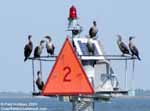
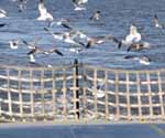
between Knott's Island and Currituck. Like all ferrys, the gulls
and terns are a constant presence on this trip, as are the
cormorants,
who watch the ferrys go by from their favorite perches on buoys
and channel markers. This particular ferry trip, for some reason,
seemed to attract many more gulls than the other ferrys, particularly
as the ferry left Currituck. Within ten minutes, though, their
number thinned out quite a bit.
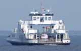
The "Gov.
J.B. Hunt Jr." was making the Knotts Island-Currituck run
on this day. It was a perfectly spectacular October day, and
the crossings were over all too soon. Each 45-minute crossing
seemed like only 15 minutes. The 9 a.m. run had only three vehicles
crossing to Knotts Island. The noon return trip to Currituck
had only four vehicles.
 If you visit Knotts Island, do not expect
to find the usual tourist amenities (fast food, motels, gift
shops of "local crafts" made in Taiwan). This is rural eastern
North Carolina, very much off the beaten tourist path. It is
a quiet, pleasant, refreshing change from the condo complex
that permeates the Currituck banks from Southern Shores to Corolla,
and beyond. Pick a beautiful sunny day, take the ferry to Knotts
Island, drive through the Mackay Island National Wildlife Refuge
to the Virginia border and back. Have a quiet picnic lunch at
one of the viewing platforms, and enjoy the return ferry ride.
It's a free ride you won't regret.
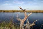
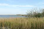
Here are a few more photos from Knotts
Island, Mackay Island National Wildlife Refuge and the Currituck-Knotts
Island ferry.
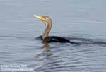 |
Left
column - Two views of Mackay National Wildlife Refuge,
and a cormorant diving for fish.
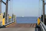
Right column - top row - Ferry slip at Currituck
& the ferry "Gov. J.B. Hunt, Jr."
Right center - On the ferry & the Currituck landing
Right bottom - Ferry crew as ferry leaves Knotts
Island slip & homes on Knotts Island |
 
Next
Ferry Page >
Bayview-Aurora
|
|
|


