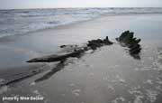
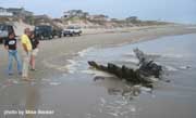
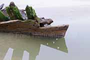
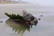
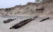
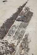
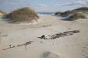
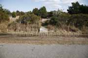
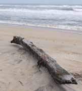
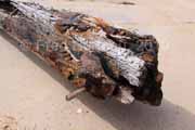
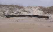
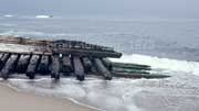
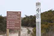
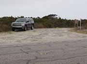
 |
 |
Visible
often |
Shipwreck
of unknown vessel (ID: Ocean Hill: 6-09-07)
(Sighting & Location Report from the "Felts Clan",
Ohio)
Almost certainly NCUAB*
ID: CKB0016
Location: 50-70 feet northeast of the
Adriatic Ave. Beach Access on Atlantic Ave, in the Ocean Hill
area between Currituck Beach Light and the horse fence/beach
ramp, off Hwy. 12 in Corolla. ONLY VISIBLE at LOW TIDE when
uncovered by sand.
GPS coordinates:
for the Adriatic Ave. beach access location
- N 36 23.135' W 75
49.629'
for the shipwreck - N
36.38599 W 75.82615
Note: This wreck is one part of a ship that washed up
here in three sections in 1998.
How To Find It: In Corolla, on NC Hwy. 12, go 3/10 -
4/10 mile north of the Currituck Beach Lighthouse and turn east
(toward the ocean) onto Coral Lane, then left (north) onto Atlantic
Ave. Follow Atlantic Ave. to the intersection with Adriatic
Ave. Directly opposite Adriatic Ave. is a sandy path beach access.
Walk down to the beach and turn north. Walk 50-70 feet north
of the beach access to the wreck, which may be visible at low
tide. Note that there is no place for parking here, so you may
need to be dropped off by car and then picked up later. Otherwise
it's a long 2/3 mile walk southward from the horse fence. It
can also be reached from the beach ramp at the end of Corolla
Village Road exactly opposite the lighthouse. The wreck is 2/3
mile north of the beach ramp. This area may be closed to beach
vehicle traffic during summer months.
*NCUAB - The
North Carolina Underwater Archaeology Branch (of the NC Office
of State Archaeology), 1528 Ft. Fisher Boulevard, South Kure
Beach, NC 28449. [ North Carolina Department of Cultural Resources
Underwater Archaeology Unit ]
|
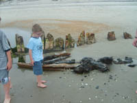 |
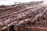
This
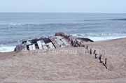
much was visible on June 9 (Saturday). By June 15 (the
following Friday) much of it was already covered up as
seen below.
 |
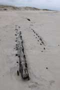
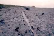
This
"Sightings and Location Report" with the four photos, all the
information and GPS coordinates, was sent in by "the Felts clan"
on June 13, 2007. The wreckage was found June 9, 2007 at 11:30
am.
These folks were on vacation and discovered
this wreck on the beach close to where they were staying. They
reported "During high tide the shipwreck is entirely underwater....during
low tide, planks are visible though sand covered."
This is just the sort of thing that happens
all the time because the beach level changes constantly, and
these wrecks are uncovered and covered repeatedly. Sometimes
they're visible one day and hidden from view the next. They're
still there, but you wouldn't know it until the tide and currents
move the sand to give you a glimpse.
Update: November, 2008
A new report arrived from Mike Becker
of Herndon, Va., which included GPS coordinates along with new
photos of this wreck site. More of the sand was washed away
revealing more of the wreckage.
Update: December, 2009
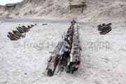
A visit to this site on December 31, 2009
provided these new photos. It turns out that this wreckage is
only 100 feet from the reported location of a 3-section shipwreck
that washed up in 1998 and is registered by the NCUAB*
as ID: CKB0016. There can be little doubt it is the same wreckage.
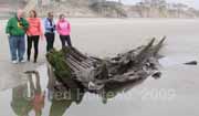
These
beachgoers give a size reference for this wreckage site. |
 |
An additional eighteen inches to two feet
of sand was gone revealing more of the wreckage. Curved planks
now made the bow plainly recognizable, and the remaining section
of the ship's center beam was uncovered as well.
The left photos show how far out this
wreckage sits from the dunes, so at high tide it would surely
be covered by surf. |
 Shipwreck
of unknown vessel (ID: Shad St. north_12-21-09) Shipwreck
of unknown vessel (ID: Shad St. north_12-21-09)
(Sightings & Location Report
from the Robertory family and the Murphy family)
NCUAB*
ID: CKB0022
Location: north of Shad St. beach access walkover, Corolla.
GPS coordinates: N/A
How To Find It: One half mile south of Currituck Beach
Lighthouse on Hwy. 12 turn east onto Shad St. and park at the
parking area just past Whalehead Drive. Then walk to the beach
via the access at the end of Shad St. and turn north. Wreckage
is 500-800 yards north of the beach access.
*NCUAB - The
North Carolina Underwater Archaeology Branch (of the NC Office
of State Archaeology), 1528 Ft. Fisher Boulevard, South Kure
Beach, NC 28449. [North Carolina Department of Cultural Resources
Underwater Archaeology Unit]
|
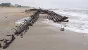
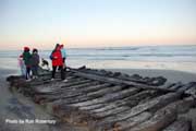 The
kids in this photo give a good idea of the size of this heavy-ribbed
wreckage. The Robertory and Murphy families noted in their report
"There were two large individual beams broken off the wreck
and further south (between Shad beach access and wreck)."
They also reported that not long after they sent their report
they noticed sand was already washing in to begin covering the
wreck again. Such is the nature of these wreck sites. They appear
and disappear completely at the whim of the ocean. The
kids in this photo give a good idea of the size of this heavy-ribbed
wreckage. The Robertory and Murphy families noted in their report
"There were two large individual beams broken off the wreck
and further south (between Shad beach access and wreck)."
They also reported that not long after they sent their report
they noticed sand was already washing in to begin covering the
wreck again. Such is the nature of these wreck sites. They appear
and disappear completely at the whim of the ocean.
This site is still under scrutiny by the
NCUAB, but preliminary information indicates this ship was approximately
20 feet wide and possibly 70-80 feet long. It shows indications
of being English built and was likely wrecked during the American
Colonial period.
|
 Shipwreck
known as the Flambeau Rd. wreck (Hatteras Village) Shipwreck
known as the Flambeau Rd. wreck (Hatteras Village)
Location: near the beach access at the
eastern end of Flambeau Rd. in Hatteras Village.
GPS coordinates: N 35.21102 W
075.68481
How To Find It: From Hwy. NC 12 in Hatteras Village turn
onto Eagle Pass Rd., then left onto Flambeau Rd. which ends
at Lighthouse Rd. There is a sandy path beach access across
from the end of Flambeau Rd. Follow it to the beach, then turn
right (southeast) on the beach. The wreckage is about 100 feet
down the beach at the surf edge.
|
 |
Northeast
end - bow
|
 |
Side
view showing size
comparison with two people |
 |
| Southwest
end of the wreck |
This
wreckage is huge compared to all the others currently visible
along the Outer Banks. It is easily 150 feet long, and literally
covered with hundreds of steel spikes, giving it the look of
a bristly porcupine. Little is known about this shipwreck, except
that it was probably a cargo ship built about the turn of the
20th century (circa 1900).
Looking at the wreckage in its present
state it's difficult to imagine that most of the time it's nearly
completely buried in the beach sand. From time to time parts
of it get uncovered to varying degrees, but these photos taken
in late December of 2009 show the majority of its bulk in open
view. Locals know it's a very rare occasion when this much of
the wreck is visible.
After weathering two strong nor'easters
in less than a month's time during November/December of 2009,
the sands of the Outer Banks have revealed several large wrecks
seldom seen, and the Flambeau Road shipwreck is certainly the
largest among them.
|
 Shipwreck
of the George W. Wells Shipwreck
of the George W. Wells
Location: Approx. 1/2 mile north of the
pony pens on Ocracoke.
GPS coordinates: N 35.15039 W
075.86210
How To Find It: Go 7/10 mile north of the Ocracoke pony
pens to the parking area along Hwy. 12. From the parking area
walk south on the beach about 700 feet. The wreckage is high
on the beach near the dunes.
|
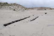 |
| The
person in the lower photo gives a sense of size to the
wreckage. |
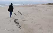 |
This
wreckage on Ocracoke, commonly attributed to the George W.
Wells, has been around for a long time. It seems to have
changed little since I first photographed it over 35 years ago.
The vertical photo at left was taken in December ot 2009, and
the lower left photo was taken from a similar angle in 1973.
Though the lower photo shows slightly more of the wreckage exposed,
there seems little difference in its location or orientation
to the dunes. The similarity between the two photos is quite
apparent even after so many years.
If more of this wreckage were visible
it would be easier to realize just how large it is. Even the
right photo with the person standing near the timbers doesn't
do a good job of conveying the actual length of the Wells still
hidden beneath the sand. Perhaps on a subsequent trip it will
be more visible and better photos can be obtained. |
 Unknown
Wreckage (ID: Albacore St. north 12-18-09) Unknown
Wreckage (ID: Albacore St. north 12-18-09)
(Sightings & Location Report
from Marc Corbett)
Location: at the base of the dunes about 150 feet north
of the Albacore St. beach ramp, Corolla.
GPS coordinates: N 36.32952 W
075.81068
How To Find It: From Hwy. NC 12 south of Corolla turn
east onto Albacore St. which ends in a beach ramp and beach
access walkover. Go onto the beach and turn north, approx. 150
feet to the wreckage. NOTE: This wreck was only visible because
storms had severely cut back and eroded the high dunes.
|
The
nor'easter storms of late November and mid December, 2009, exposed
a number of wreck sites along the Outer Banks. This is one of
them, which appeared when the dunes in the Corolla area were
severely eroded because of storm wave action.
The visible portion of the central beam
was over 50 feet long, making this one of the larger wrecks
along the Outer Banks. It would hardly take a foot of sand to
cover this wreckage, and if the dunes build up again, it will
be hidden even deeper once again. |
 Shipwreck
known as The Iron Sheathing Wreck Shipwreck
known as The Iron Sheathing Wreck
Location: behind the first row of dunes
approx. 1/2 mile south of Ramp #27, Hatteras Island.
GPS coordinates: N 35.46246 W
075.48292
How To Find It: Take Ramp #27 onto the beach and go south
approx. .5 miles. Walk between and behind dunes to find it.
NOTE: This can easily be covered by an inch of sand and be missed
completely, since it lies flat.
|
 |
 |
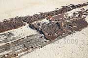
The
"Iron Sheathing Wreck" gets its name from the rusted iron plates
that cover it, which can be plainly seen in the left photo.
Only a few feet of this wreckage was visible on the day these
photos were taken, and even that was just barely visible.
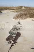
The right photo is looking northwest,
and shows how this wreck sits among many low dunes. In this
environment it can very easily be covered by blown sand, and
in fact, just one inch of additional sand would have completely
hidden it from view. When looking for wreckage in this situation
it would be good to trust the GPS coordinates and poke at the
sand with a thin stick or rod to reveal its location just below
the sand in the event it isn't visible.
The right photo here shows the relationship
of the wreckage to the beach, visible between the dunes in the
photo. Without GPS coordinates, it would be very unlikely that
wreck sites like this one would be found, although I did in
fact locate this based on the "1/2 mile south of Ramp 27"
directions alone, but also knowing that I would have to look
behind the dunes. In truth I walked right over it (footprints
visible in the right photo) before realizing it was the wreck
and not just some dark colored flotsam washed behind the dunes.
|
 Searching
for the 1896 Shipwreck of the Schooner E. S. Newman Searching
for the 1896 Shipwreck of the Schooner E. S. Newman
Location: reported to be on the beach
about 1.6 miles south of the New Inlet boat ramp on Pea Island.
GPS coordinates: vicinity of N
35.652861 W 075.473229
How To Find It: No beach driving access
is allowed on Pea Island. From the New Inlet boat
ramp access on NC Hwy. 12 (New Inlet is at milemarker 34), go
1.7 miles south and park along the roadside. Here there is a
small wooden "bridge" across the ditch on the east side of the
road at N 35.65121, W 075.47665.
Cross the ditch and look left (north) where there is a path
that leads to the beach. Follow the path and you will come over
the dunes directly at the reported coordinates (as above) of
the E.S. Newman wreckage.
|
I
have not yet been able to locate the wreckage or verify the
coordinates as reported. My first problem in the search for
the E.S. Newman wreckage was to find foot access to the
beach near the reported site, since there are no 4x4 beach ramps
on Pea Island, and no beach driving is allowed there. Much of
the area next to the road is covered in heavy brush, thickets
and small pine trees, making it difficult to reach the dunes
from the road. In addition. the ditch is often filled with water
and wide enough that it is difficult to jump across. I finally
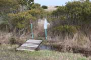
stumbled upon a small wooden bridge across the ditch near the
E.S. Newman site, adjacent to an area mostly bare of
the troublesome thicket found elsewhere. That location is shown
in the left photo.
From here the beach is relatively easy
to reach via an apparently well-used foot path. Upon crossing
the ditch, the path is plainly visible off to the left. In fact,
when the location was plotted on Google Earth it actually showed
the foot path in the aerial photo map on Google Earth. As there
is no other reason I can find for this bridge or path to be
in this location, it must be tied to the wrecksite. The path
comes out onto the beach directly at the reported coordinates
of the wreckage. Please note that hiking in this area without
boots is ill advised. When I returned to my vehicle after my
search I had a piece of cactus with a dozen 3-inch spines jammed
into the toe of my boot (yes, there is a cactus that is a common
plant here). Flip-flops and beach sandals are NOT advised as
safe attire when hiking here. I've even had the things attack
my truck tires as evidenced by this photo.
Update: March, 2010
A subsequent visit to the site during better weather than the
first visit allowed me to carefully check the coordinates I
was working from. I found out those coordinates would have put
me some twenty feet into the surf, even at low tide. It is possible
the coordinates are not accurate. It's also possible any wreckage
is completely covered with sand higher on the beach. During
both my attempts to locate this wreckage I noted that another
well-known wreck in the area, the G.A. Kohler, was also completely
covered from sight. I know the Kohler comes and goes from sight
as the beach builds and washes, so I will plan to revisit these
Newman coordinates at a time when the Kohler is once again visible.
| This
and all other wreck locations on CarolinaOuterBanks.com
can be obtained already plotted for you on Google Earth
simply by downloading
my "KMZ" file. If you have Google Earth installed
on your computer (free download from Google Earth at http://earth.google.com)
then downloading this file will automatically offer to
open Google Earth and show you these shipwreck locations. |
|
 Unknown
Wreckage (ID: UNK_Pea Island_3-28-10) Unknown
Wreckage (ID: UNK_Pea Island_3-28-10)
Location: at the high tide line on Pea
Island about
MM35.8 or about 1.8 mi; south of
the New Inlet boat ramp access
GPS coordinates: N 36.64902 W
075.47261
How To Find It: Follow the directions to reach either
the E.S. Newman above, or the M.A. Spencer below.
Located about half way between the two, and within sight of
their reported coordinates.
This single beam was found while searching
for the Newman and the Spencer, and is approximately
half way between the reported locations of those two wreck sites.
It sat just at the high tide line, likely having been deposited
there by the surf. As such, it will very likely be moved easily
by the next tide high enough to float it again, and is not expected
to remain where it is.
Could it be a piece from either of those
two wreckages? It's a possibility, but no more likely than to
be from some other wreck along this coast. It is surely a piece
of wreckage because the tell-tale pitch deposits and spikes
were present as shown in the top right close-up. It measured
approximately 22 feet long.
|
 Searching
for the Schooner Margaret A. Spencer Searching
for the Schooner Margaret A. Spencer
Location: reported to be on the beach
about 2 miles south of the New Inlet boat ramp on Pea Island.
GPS coordinates: vicinity of
35.646027 W 075.472219
How To Find It: No beach driving access
is allowed on Pea Island. Park along NC Hwy. 12 at
2 miles south of the New Inlet boat ramp access. Look for an
area of minimal vegetation where you can cross the ditch on
the east side of the road and walk east toward the beach. You
should come over the dunes very close to the reported area of
the wreckage. Crossing a water-filled ditch may be difficult
without bringing along a thick wide plank 3-5 feet long to use
as a temporary "bridge". Alternately, use the existing
"bridge" noted in the previous entry above that leads to the
reported location of the E.S. Newman, then walk along
the beach approx. 3/10 mile south to the reported coordinates.
|
I
have not located the M.A. Spencer at the coordinates
reported above. The reported coordinates fall between the driftwood
and the surf line in this photo at right. It is possible the
coordinates are inaccurate and the wreck is covered higher on
the beach. I will continue to check this location.
Below are some photos I took of the wreckage
as it existed in 1973. Perhaps some day soon I will find it
uncovered again.
|
 Unknown
Wreckage (ID: UNK_Pea Island_3-30-10) Unknown
Wreckage (ID: UNK_Pea Island_3-30-10)
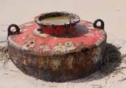
Red Metal "tank" - possibly
old sea bouy floatation base
Location: at the high tide line on Pea
Island about
MM36.1 or about 2.1 mi; south of
the New Inlet boat ramp access
GPS coordinates: N 35.64422 W
075.47188
How To Find It: Go 2 miles south of the New Inlet boat
ramp access and watch for a wooden plank "bridge"
across the ditch (further details below). Cross ditch and follow
well-marked path to beach, then turn south.
A second well-marked "bridge" across the
ditch was found at GPS coordinates N 35.64455,
W 075.47482 while searching for a cross-over near the
reported location of the M.A. Spencer. This bridge accesses
a well-used path marked every 30 feet or so by wooden stakes
with red reflective tape. Very likely this was installed by
the Park Service, as the path comes out onto the beach next
to a marked protected area, possibly a bird nesting site.
Turning north will take you to the reported
coordinates of the M.A. Spencer. However, going some 50 - 100
feet south will take you to the large red metal "tank" shown
in these photos. Best guess is that this is the floatation base
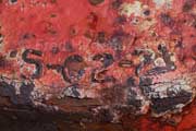
for an old sea bouy. It is marked with the identification "5-C2-21".
While this isn't the usual wooden wreckage,
it is an interesting and colorful sight on the beach, and was
found as a result of looking for another access to reach the
sight where the Margaret A. Spencer is reported to be.
|
 Searching
for the 1899 Shipwreck of the barkentine Priscilla Searching
for the 1899 Shipwreck of the barkentine Priscilla
Location: reported to be on the beach
about 8/10 mile south of Ramp #27, which puts it just 3/10 mile
south of the Iron Sheathing Weck on Hatteras Island.
GPS coordinates: vicinity of
N 35.458859 W 075.482629
How To Find It: From NC Hwy.12 south of Salvo take Ramp
#27 onto the beach and go south 8/10 mile. Alternately, stay
on Hwy. 12 and go 8/10 mile south of Ramp #27 to the Soundside
access #48 drive entrance. There is space to park here beside
the drive safely off the road. Cross the road, jump the ditch
in a clear spot and walk about 200 feet to the beach.
|
The
photos at right show the place to park so you can walk to the
beach from Hwy. 12. Though I have found how to most easily reach
the beach where the wreckage is suppose to be, I have yet to
locate the uncovered wreckage of the Priscilla. The search
will continue.
|
 Searching
for the Robert W. Dasey Searching
for the Robert W. Dasey
Location: reported to be on the beach
about 1.2 miles north of Ramp #34 or 3 miles south of Ramp #30
on Hatteras Island.
GPS coordinates: vicinity of
N 35.458859 W 075.482629
How To Find It: From NC Hwy.12 south of Salvo (and north
of Avon) take Ramp #34 onto the beach and go north 1.2 miles.
Alternately you may take Ramp #30 and go south for 3 miles.
There is also a deer crossing along the highway adjacent
to the reported wreck location at a spot relatively clear of
undergrowth located at N
35.394770, W 075.491670.
|
I
have not
located the uncovered wreckage of the Robert W. Dasey.
Since this wreckage is so far from both Ramp #30 and Ramp #34,
I searched for foot access from highway NC 12 in hopes it might
be easier. I came across an area almost due west of the wreck
location where the usual heavy thicket had an opening that looked
passable and found there was a handy dandy deer crossing of
the ditch right at that very spot. Though the ditch was filled
with water, it was barely narrow enough that I could jump across
(with some difficulty) and reach the beach, though even here
the beach is a stroll of 2/10 mile from the road. Bringing along
a couple of wide, thick 3-foot to 5-foot long planks to use
for crossing the ditch would be very helpful in these situations.
The deer crossing is located at GPS coordinates N
35.394770, W 075.491670 , which puts it the same distances
from the beach ramps as the wreck site itself (as noted above
in the "How To FInd It" section). Incidently, while hiking across
to the dunes I spotted deer tracks, and spooked a deer grazing
among the pine trees.
Update: March, 2010
I took a second trip to the site by way of the deer crossing.
With better weather this time I was able to verify the coordinates
reported for the Dasey actually fall twenty feet into
the surf, even near low tide time. The coordinates may be wrong,
the beach may have changed or the wreckage could be covered
with sand farther up on the beach. Like the Newman, the
Spencer and the Priscilla, all of which are along
the same stretch of beach, these may become visible at a time
when the Kohler is again uncovered. |
Historic
life-saving stations and heroic rescue stories are next.
Continue to Folklore and History - Page
Three "A" > |
|


