 |
 Unknown
Wreckage (ID: UNK-9_10-19-04) Unknown
Wreckage (ID: UNK-9_10-19-04)
Location: Ramp #43, Cape Point, Hatteras
Island.
GPS coordinates: (as of October, 2004) N
35.23525 W 075.52723
How To Find It: Take Ramp #43 onto the beach and turn
south. Just 30 ft. or so on the right is a heavy double beam
section of wreckage. It is also only a very short walk from
the paved parking area next to Ramp #43, so a 4WD is not really
necessary to access this site.
|
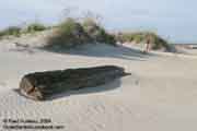
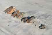
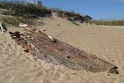
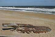
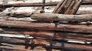
 This
heavy chunk of wreckage was discovered near Ramp #43 at Cape
Point. It was found, like many others on these pages, in October,
2004, after an active hurricane season on the Atlantic coast.
The metal spikes were heavily rusted, indicated it had been
exposed to the elements long before it washed up here. This
heavy chunk of wreckage was discovered near Ramp #43 at Cape
Point. It was found, like many others on these pages, in October,
2004, after an active hurricane season on the Atlantic coast.
The metal spikes were heavily rusted, indicated it had been
exposed to the elements long before it washed up here.
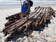
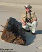
The people in the background of the upper
left photo are walking down Ramp #43, showing the proximity
of the wreckage to the ramp. Cape Hatteras Lighthouse is visible
in the far background. The lady in the photo was kind enough
to take these pictures of the author next to the wreckage, providing
a scale to judge the size of these heavy beams.
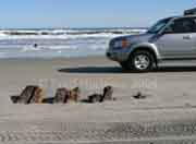
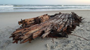
The lower left photo shows the wreckage
position relative to the ocean. A winter storm could easily
move this wreckage from this unprotected position at the cape.
The cape had changed size and shape considerably from the previous
visit only 6 months prior, indicating how greatly hurricanes
and storms affect the beach and dunes.
Update - Ten weeks after the initial October discovery
of this site it was checked again. The wreckage was still located
in the very same spot, though it was already half buried in
blown sand, but still visible. Cape Point south of this site
had changed dramatically in those ten weeks, even more so than
during the previous 6 months as reported above. |
 |
Visible
rarely |
Unknown
Wreckage (ID: UNK-10_12-28-04)
Location: One mile north of the beach
ramp, north of Corolla at the end of Hwy. 12.
GPS coordinates: (as of December, 2004) N
36.41137 W 075.83271
How To Find It: From the ramp north of Corolla at the
north end of Hwy. 12, go one mile north on the beach. If visible,
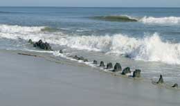
ribs are protruding from the beach during low tide. May initially
be mistaken for more tree stumps until you get close and see
the squarish beams in a tight row.
|
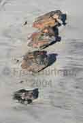 On
the way north to take more photos of wild horses at Carova,
the author stopped in Corolla at "Winks of Corolla", a small
mini-mart/gas station just north of the lighthouse. Inside he
noticed a postcard picturing a wreck he had not heard about
and asked the clerk about it. She said the wreck was sometimes
visible and was not far from the beach ramp. So on the way north
to Carova a careful eye was kept for anything resembling this
wreck. On
the way north to take more photos of wild horses at Carova,
the author stopped in Corolla at "Winks of Corolla", a small
mini-mart/gas station just north of the lighthouse. Inside he
noticed a postcard picturing a wreck he had not heard about
and asked the clerk about it. She said the wreck was sometimes
visible and was not far from the beach ramp. So on the way north
to Carova a careful eye was kept for anything resembling this
wreck.
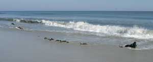
Among the jumble of tree stumps that populate
this area of the beach there was a row of what looked like small
tree stumps higher on the beach than the others. These turned
out to be the ribs of the wreck seen on the postcard. Looking
at the photos you can see how closely vehicles pass by this
wreck, and in fact, drive right over top of it, not knowing
what is under the sand. |
 1925
Shipwreck of the Three-masted Schooner Irma 1925
Shipwreck of the Three-masted Schooner Irma
(previously listed as Unknown Wreckage (ID: UNK-11_11-02-05)
Location: 100 ft. north of the beach walkover steps
at the Asheville Drive Public Beach Access, near mm7.5 on Hwy.
12 beach road in Kill Devil Hills.
GPS coordinates: (as of November, 2005) N
36.024710 W 075.66153
How To Find It: In Kill Devil Hills, on US 158 go to
the stop light at the entrance to the Wright Brother's Memorial
site and turn east onto Prospect. This takes you to the "beach
road" (old NC 12). Turn north on NC 12 and you will quickly
come to the Asheville Drive Public Beach Access parking lot
on the east side of the road ( this access is 500 ft. south
of mm7.5 ). Park and walk over the boardwalk onto the beach.
The wreckage is at the base of the dunes beside the next set
of wooden steps, 100 ft. north of the beach access steps, as
shown in the photo below.
|
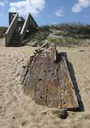 This
large chunk of wreckage was discovered quite by accident while
on a quick early morning visit to the closest beach access hoping
for a nice sunrise photo. There was a fierce 30-40 mph wind
whipping along the beach from the north, so facing southeast
toward the expected sunrise and away from the wind was much
warmer. It was soon obvious the sunrise photo was not going
to happen due to the thick clouds on the horizon. A fleeting
glance to the north into the biting wind as the author turned
to leave revealed this wreckage a mear 100 feet up the beach. This
large chunk of wreckage was discovered quite by accident while
on a quick early morning visit to the closest beach access hoping
for a nice sunrise photo. There was a fierce 30-40 mph wind
whipping along the beach from the north, so facing southeast
toward the expected sunrise and away from the wind was much
warmer. It was soon obvious the sunrise photo was not going
to happen due to the thick clouds on the horizon. A fleeting
glance to the north into the biting wind as the author turned
to leave revealed this wreckage a mear 100 feet up the beach.
These photos were taken later in the day
after the clouds blew away and the sun came out, and the wind
had calmed to a mear 20 mph or so. It's size can be gauged by
comparing it to the steps in the above photo.
Update: December 2009 - After two strong
nor'easters of late November and mid December of 2009 this wreckage
was not visible. It was either covered with sand, or more likely
moved by the ocean's fickle whim. |
 Unknown Wreckage (ID: UNK-14_2-15-16) Unknown Wreckage (ID: UNK-14_2-15-16)
(possibly a piece from the Three-masted Schooner
Irma, previously reported just 1/4 mile north
of this location)
Location: just south of the Glenmere Avenue Public Beach Access on Hwy.
12 beach road in Kill Devil Hills.
GPS coordinates: guesstimated from report (as of February
15, 2016)
N 36.021424 W
75.658858
How To Find It: In Kill Devil Hills, on US 158 go to
the stop light at the entrance to the Wright Brother's Memorial
site and turn east onto Prospect. This takes you to the "beach
road" (old NC 12). Turn south on NC 12 and immediately on the
left is Glenmere Avenue Public Beach Access parking lot on the
east side of the road ( this access is 500 ft. south of mm7.5
). Park and walk over the boardwalk onto the beach. Turn right
and walk south on the beach to look for the wreckage along the
surf line.
|
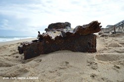
 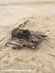 This
chunk of wreckage was discovered and reported by Stephanie Banfield
on Feb. 15, 2016. Stephanie's short report stated, " I found
it today just south of the Glenmere beach access in Kill Devil
Hills, right in the surf line". These photos, supplied by Stephanie
show her next to the wreckage, and some other views. This
chunk of wreckage was discovered and reported by Stephanie Banfield
on Feb. 15, 2016. Stephanie's short report stated, " I found
it today just south of the Glenmere beach access in Kill Devil
Hills, right in the surf line". These photos, supplied by Stephanie
show her next to the wreckage, and some other views.
|
 |
Visible
often |
Unknown
Wreckage (ID: UNK-12_10-03-06)
Location: 500 ft. or more north of the
beach walkover steps at the Asheville Drive Public Beach Access,
near mm7.5 on Hwy. 12 beach road in Kill Devil Hills. ONLY VISIBLE
at LOW TIDE
GPS coordinates: (as of October, 2006) N
36.02686 W 075.66237
Note: This wreck isn't going anywhere anytime soon. It
is so far under the sand it would take a major storm to uncover
and move it. However, the visible tips will easily be covered
and uncovered as the sand builds and washes in this location.
It would only take a foot of sand to make it disappear from
view.
How To Find It: In Kill Devil Hills, on US 158 go to
the stop light at the entrance to the Wright Brother's Memorial
site and turn east onto Prospect. This takes you to the "beach
road" (old NC 12). Turn north on NC 12 and you will quickly
come to the Asheville Drive Public Beach Access parking lot
on the east side of the road ( this access is 500 ft. south
of mm7.5 ). Park and walk over the boardwalk onto the beach.
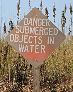
Go north up the beach. It is marked by signs at the dune line,
posted near either end of the wreckage, which say "Danger
Submerged Objects In Water". (Note: Dec. 2009- these signs
had been washed away along with part of the dunes.) The wreckage
is about 5 or 6 buildings north of the beach access steps. It
can only be seen at lowest tide, and probably only when the
ocean is fairly calm, and there is no wind from the NE or East
to keep the low tide from receding fully.
(This wreckage is very close to the wreck ID: UNK-11_11-02-05
above. It is only 4 or 5 buildings north of UNK-11.)
|
 |
Looking
north sighting from
the bow toward the stern |
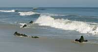
This
a very long wreckage. The part that was visible on the day these
photos were taken stretched along the beach for 40 paces of
the author, which calculates to about 110 feet. I actually found
this in the dark, about 10 pm, walking on the beach under a
3/4 moon. I didn't even have a flashlight. I returned to my
room to get my camera and a light, but I only had a tiny 2xAA
battery penlight, which was barely enough to allow the camera's
autofocus to work if I fiddled with it long enough. I got a
couple of usable shots with the flash that night just to verify
what I was seeing was a wreck, because I could not tell for
sure by the flashlight. I wanted some verification in case I
could not find it the next day.
The next day at low tide I went back out
and found it easily. That's when I discovered the warning signs
posted at the dune line, aligned near each end of the wreck
(shown at right).
 |
| This
gives some idea of the size of this wreckage. What you
see in this shot is only about one-third of the
length, as compared to the beachgoer standing next to
it. |
|
 |
 |
This
shows the northern-most
third of the wreckage. |
This
shows most of the length from more of a side angle, still looking
northward. |
 Unknown
Wreckage (ID: UNK-13_9-21-08) Unknown
Wreckage (ID: UNK-13_9-21-08)
Location: southmost sand spit, Cape Point,
Hatteras (at Buxton).
GPS coordinates: N 35.21855 W
075.53007
How To Find It: From ramp 43 or 44 at Cape Point, Hatteras,
go south along the beach until you reach the point. This long
beam was in the middle of the widest area just north of the
point's tip.
|
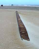 The
left and right photos show either end of the very large and
long beam sitting in the open at Cape Point. This piece has
obviously either been uncovered or washed up recently, as it
has not been seen before during any of the many repeated trips
to this same spot in the past five years. It appeared in good
condition, and was similar in appearance to the wreckage at
the top of this page identified as ID: UNK-9_10-19-04. It may
very well be from the same wreck. The
left and right photos show either end of the very large and
long beam sitting in the open at Cape Point. This piece has
obviously either been uncovered or washed up recently, as it
has not been seen before during any of the many repeated trips
to this same spot in the past five years. It appeared in good
condition, and was similar in appearance to the wreckage at
the top of this page identified as ID: UNK-9_10-19-04. It may
very well be from the same wreck.
This beam was a good foot across in width,
and as you can see by the photo below of the beam shown next
to the truck, it was nearly three times as long as the full-sized
crew cab truck. The truck measures 19 feet, and the beam seems
to be about 56 feet long. Both ends of the beam were cut at
the same angle as if to be lap-joined with another section.
If so, it had to be from a pretty large ship.

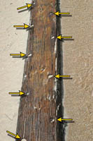
The two close-ups above show details of
the beam. The left photo with the arrows shows the evenly spaced,
alternating holes in the beam where wooden dowels or iron bars
were used to join the beam to its neighbor. The right photo
shows the rusty-looking layer of filler that sealed between
the beams. In the same shot there is one dark spot, which is
a broken dowel still in its hole. These are clues which help
identify wreckage from other wooden flotsam that often washes
up on the beach after storms.
Considering that this wreckage is on Cape
Point, it is highly likely that it will be moved or will disappear
during the next storm. Cape Point is constantly reshaped by
the elements, and looks different on every trip there.
Note 1: On each subsequent trip to this location this
long beam has been gone as expected. There is little chance
it will reappear here. |
Other
Wrecks Reported Along The Outer Banks
The wrecks in this section have been reported by folks just
like you who visited the Outer Banks and discovered wreck sites
not previously reported here on CarolinaOuterBanks.com. They
sent in their photos and wreck reports to share their discoveries
with everyone. If you have information or reports to send, or
have better, newer photos and information about a wreck site
already listed on our site, please send them along. You will
be credited for your efforts. |
 |
Visible
often |
Shipwreck
of unknown vessel (south Nags Head: 7-12-03)
(Sightings & Location Report from Dennis Coz, Parkman Twp.,
Ohio)
Location: Nags Head, on the beach at the edge of the
surf, at approximately the 15 1/2 milepost.
How To Find It: (Note: this is likely not currently
visible, but it's worth watching for if in the area.) In
Nags Head, go to the Blue Heron Motel at mile marker 15 1/2
(or 1/2 mile south of MM 15) on NC Hwy 12 (the beach road).
Immediately adjacent to the motel, on the south side, is a public
beach access. Cross to the beach at this public access and walk
200-300 feet south along the beach. Low tide is probably best.
(There is also the Glidden St. beach access 0.17 mi. south of
the Blue Heron.)
|
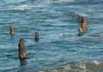
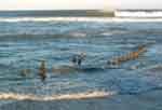
Dennis
Coz of Ohio sent in this "Sightings and Location Report" with
the two great photos at right. This apparent shipwreck is right
in Nags Head.
Dennis discovered this site July 12, 2003.
Dennis writes, "Everyone else, including the locals that I talked
to seemed oblivious to what was in the water, but it sure looked
like a shipwreck to me. One person did say that it just appeared
a few weeks before we were there. Obviously it is probably gone
again after the storm last year [Hurricane Isabel, Sept. 2003]."
Dennis adds, "A little more info on the pictures. They were
taken 7/12/03 at 11:37 AM and 11:39 AM with a Fujifilm Finepix
3800, 3.2 megapixel digital camera..."
 |
 |
| Dec.
2004 photos |
Update - December 2004:
Dennis is a frequent visitor to the Outer
Banks, and reported earlier that "We were there in May of 2004
and it was not visible." But on the latest visit, it was visible
once more. Dennis writes, "We visited the Outer Banks in early
December. Much to my surprise, the unknown shipwreck on the
beach at Nags Head had reappeared. It is still where it originally
was sighted in 2003, between MP15 and MP16 on the beach road."
..... "The photographs were taken at about 4:00 PM on December
1, 2004. I believe it was near low tide at the time. I noticed
that the water is higher on the beach than in the past, possibly
due to erosion from the recent high surf that was reported in
late fall. The timbers appear to be more exposed from the sand
than in 2003, however since the water is higher on the beach,
it is now all within the surf, and not at the edge of the beach
as was reported in 2003."
New Update: January 2020: Dennis Coz reports that this wreck has not been visible on his annual visits since his 2004 reports, perhaps due to so much beach replenishment after so many storms.
|
 |
Wreckage
of unknown vessel (ID: UNK-14_04-22-11)
(Sightings & Location Report from Lee Hutchison, Charlotte,
NC)
Location: Approximately one half mile north of Ramp #30,
located in the grassy area 50 feet behind (west of) the beachfront
dunes.
How To Find It: The location is approximately half way
between Salvo and Avon on Hatteras Island. Park in the paved
parking area at Ramp #30 and walk north. If 4WD access is permitted
at the time of your visit, you could take Ramp #30 over to the
beach and drive north 1/2 mile.
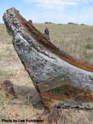
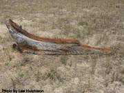
These excellent photos by Lee Hutchison
of Charlotte were sent in with his wreckage report. Mr. Hutchison
reported, "I found the wreckage quite by accident. It is about
6 feet in total length and 3 feet in height..."
When these photos were sent to the N.C.
Office of State Archaeology, the responding archaeologist/conservator
reported that it appeared to be the "...stern post knee and
deadwood or the forefoot of a pretty large wooden vessel." He
also noted there were "...numerous copper tacks in the lower
part of the structure that once held copper sheathing to the
outer hull."
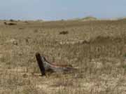
The uppermost left photo shows the relationship
of the wreckage to the beach dunes in the background. The other
photos provide an excellent look at the details of this interesting
find. |
| |
 |
Ramp
55 Wreck
(Sightings & Location Report from Danielle Basso, Oneonta, NY)
Location: Between 4/10 - 6/10 miles SW of Ramp #55, located
on the beach in the surf zone, and can be covered by water at
high time. Apparently it is alternately covered by sand, and
uncovered by wave action from time to time.
How To Find It: Go to the southern end of Hatteras
island past the ferry entrance to the
Graveyard of the Atlantic Museum. Take Ramp #55 onto the beach and head SW along the surf. Conflicting coordinates put it somewhere between 4/10 and 6/10 mile from the ramp.
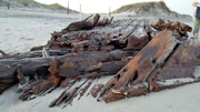
This wreckage has been known for quite
some time, having been dubbed the "Ramp 55 Wreck"
long ago, though the author had not found this particular wreckage
in his many searches. But finally we have a report from Danielle
Basso with great photos.
An internet article from Cape Hatteras National Seashore
in 2006 stated the park service, along with the Graveyard of
the Atlantic Museum, conducted an archaeological study of the
Ramp 55 Wreck. Not much is known of the site except that the
wreckage is of a six-masted schooner dating sometime between
1870 and 1900.
Danielle's report of May 1, 2017 said,
"...while beachcombing with my mother ... we came across...
wooden wreckage while hiking to the southwestern most point
of Hatteras island. This definitely was not exposed when I was
there in Sept. of 2016. We parked at the lot by the Graveyard
of the Atlantic museum and entered the beach via the wooden
footpath. We continued southwest along the beach. (The wreckage)
is very exposed right now but may be covered at high tide."
Danielle's photos shown here provide a
good look at this wrecakge, and some reference for it's size
compared with some beachcombers in view. |
| |
Historic
life-saving stations and heroic rescue stories are next.
Continue to Folklore and History - Page
Five > |
|


