 |
 |
| Historic
marker on Ocracoke, located near the ferry dock and old
Coast Guard Station. |
History
and legend go hand in hand on the Outer Banks. Weave in some
ghost stories and mysteries, pirates, shipwrecks and unselfish
bravery, and you have the fabric that makes up the folklore
of the Outer Banks. There is history surrounded by legend, not
the least of which is Blackbeard, whose mark is all around the
coast of North Carolina, from Bath, to Beaufort, to Ocracoke
and beyond. Ghost ships and mysterious sightings, and other
tales live on of dreadful fates of shipwreck victims spawned
by the truth that is the "Graveyard
of the Atlantic". Magical, mystical tales, such as those
told by superstitious men of the sea, weave their threads into
those stories of the crews of the Life-Saving Stations, whose
fearlessness in the midst of deadly storms is factual, recorded
history, now become legend.
With such a wealth of material to draw
upon, how do you decide what can be highlighted in the space
of a web page or two? Certainly it is not easy. Books such as
Charles Harry Whedbee's "The Flaming Ship of Ocracoke and
Other Tales of the Outer Banks", and his "Legends of
the Outer Banks" provide good reading on many of the less
widely known stories. Here though, the aim is to entice you
into looking further into it for yourself. |

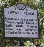 So,
what about Blackbeard, the infamous Edward
Teach (or Thatch, or Tatch, as variations exist on the name)?
Was he real? The answer is "yes", as real as they come. Of course
his "image" is likely to be a little larger than life, but apparently
he earned every bit of it. There is no shortage of writings
about him and his exploits, so that will not be repeated here.
But if you go to the Outer Banks, to Ocracoke, or historic Bath,
ride the ferry from Bayview to Aurora, or Hatteras to Ocracoke,
or across Pamlico Sound, then you are treading the very grounds
and sailing
the waters he called home. (More detailed information on
Blackbeard and his dubious exploits is contained in this background
document.)
 |

Wreck
of the "Altoona", Oct. 22, 1878, at Cape Point, Hatteras. |
But the history of this place will tell
you it wasn't pirates that mariners feared most along the Outer
Banks, it was the shoals, the shallows and the vicious storms
that took more ships than pirates ever dreamed of scuttling.
Shipwrecks were in fact an integral and important part of life
on the Outer Banks. Being so isolated, the residents made good
use of everything, especially salvaged cargo from wrecks, including
the wood, beams, ropes and hardware from the ships themselves.
Nothing went to waste. Many homes were built, furnished or repaired
from ship salvage. |
Finding The
Shipwrecks
Thirty
years ago there were more wrecks visible onshore than there
are today. Time and storms have taken their toll. Wrecks get
washed ashore, then covered by sand, then uncovered in storms,
and covered again. Over the years they get moved by storms,
as well as broken apart and scattered.
| Guide
to Wrecksite Icons: |
 In
the water but partially visible - stationary long-term In
the water but partially visible - stationary long-term |
 On
the beach - stationary - gets covered and uncovered
by sand and/or high tide. May include the notation
- Visible "often" or "rarely" On
the beach - stationary - gets covered and uncovered
by sand and/or high tide. May include the notation
- Visible "often" or "rarely" |
 On
the beach - likely transient - easily moved or washed
away On
the beach - likely transient - easily moved or washed
away |
 Off
the beach on higher ground Off
the beach on higher ground |
 Dispostion
unknown Dispostion
unknown |
|
Locating the remains of shipwrecks on
the Outer Banks is not necessarily as easy as the tourist pamphlets,
travel brochures and other web sites might imply. Many or most
of the brochures, and especially the web sites are publishing
inaccurate and out of date information. Some even publish locations
using beach ramp numbers that no longer
exist and were changed by the park service over a decade ago!
Of course, we are talking about wreck
sites which are on the beach, in the surf or near shore where
they are visible and accessible to the average visitor. There
are also underwater wreck sites, which require scuba
gear and experience to reach. Other web sites are devoted to
this interesting sport activity, but that is not within the
scope of these pages.
It is important to remember that it
is illegal to deface or remove any wreckage or pieces thereof
located on U.S. Park Service land.
Please keep in mind that many of the smaller
pieces of wrecks listed in these pages either are moved around
by the storms and tides, or are covered and uncovered randomly
at the whim of nature. These are virtually impossible to keep
updated, and more often than not, will disappear within days
or weeks of being found and recorded here. Most in this category
are labeled as "Unknown Wreckage" with an ID in the "UNK-#_date"
format. If it has a name (example- the "Laura Barnes") then
it's probably been stuck for decades right where it is now.
Unless otherwise noted, these are the sites you can actually
expect to find. Remember though, even these can be covered and
uncovered by sand. They just don't get washed from place to
place. The fun part is that if you do go looking, you might
find another site of wreckage all on your own.

Directions for finding these sites are
noted by using 4WD beach access "Ramp" numbers (How
to find Ramps) and the mile markers along NC Highway 12
on the Cape Hatteras National Seashore, which look like the
example at right. Watch for them. For those of you with GPS
receivers, we also provide GPS coordinates in the Decimal Degree
format (hddd.ddddd°, also called dd.dddd°). If you need
to convert them to other formats, click
here for some handy conversion pages.
For those of you with Google Earth installed on your
computer (it's a free download, by the way) you can download
our .KMZ file and go to any of these shipwreck sites virtually.
| Wreckage
Site Directory |
| This
Page |
Page
Two |
Page
Three |
Francis
E. Waters
Laura A. Barnes |
Oriental
Pocahontas
G.A. Kohler
Altoona
unk-1_10-16-04
unk-2_10-16-04
|
Ocean Hill: 6-09-07
Shad St. north_12-21-09
Flambeau Rd. wreck
George W. Wells
Albacore St. north 12-18-09
Iron Sheathing Wreck
E. S. Newman
Margaret A. Spencer
Priscilla
Robert W. Dasey |
| Wreckage
Site Directory |
| Page
Three A |
Page
Four |
unk-3_10-20-04
unk-4_10-20-04
unk-5_10-20-04
unk-6_10-20-04
unk-7_10-20-04
unk-8_10-20-04 |
unk-9_10-19-04
unk-10_12-28-04
Irma
unk-12_10-03-06
unk-13_9-21-08
unk- Nags Head: 7-12-03 |
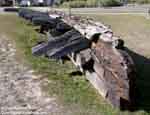
 1889 Shipwreck of the Schooner Frances
E. Waters
 Location:
Nags Head Town Hall parking lot (no kidding) Location:
Nags Head Town Hall parking lot (no kidding)
GPS coordinates: N/A
How to find it: The entrance to Nags Head Town Hall complex
is at the base of the Nags Head water tower, easily found on
the east side of US 158, south of Jockey's Ridge and north of
Whalebone junction. Turn east into the town hall complex entrance,
marked with a sign. The shipwreck is in the grass median in
the middle of the parking lot. There is an interpretation display
which features four newspaper articles about the wreck. At right
is an aerial
view of the location.
|
 |


|
 The
Frances E. Waters sank in October, 1889. It sat on the beach
at Nags Head until a storm in May of 1978 picked it up and floated
it southward, crashing through Jennette's pier, cutting the
pier in two. The storm then carried the wreck south to Oregon
Inlet. The city moved it back to Nags Head to rest outside city
hall.
 |
|
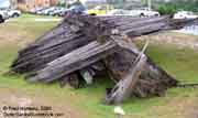
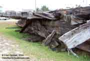
The
photos at right and below, added in October, 2004, were
taken on a cloudy day to minimize deep shadows, and may
show a bit more detail than the set above.
 |

 |
 |
 |
Visible
often |
1921 Shipwreck
of the Schooner Laura A. Barnes
Location: Coquina Beach
- Cape Hatteras National Seashore. Coquina Beach entrance is
located on NC Highway 12, exactly across from the entrance road
to Bodie Island Lighthouse.
GPS coordinates: N 35.83226 W
075.55751
 How To Find It: Coquina Beach is on NC Hwy 12, south
of Whalebone junction/Nags Head, and north of the Oregon Inlet
Bridge. The entrance to Coquina Beach (and Bodie Island Lighthouse)
is 7/10 mile south of mile marker 22. Turn east off the highway,
park in the parking area, and walk north to the bath house/restroom
area. The boardwalk from the bath house takes you over the dunes
to the beach. Immediately at the end of the steps down to the
beach you will find the remains of the Laura A. Barnes. The
aerial
photo above right shows the parking area, bath house, boardwalk
and the wreck site.
|

Above:
the view at bottom of boardwalk steps |
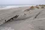 |
The
Laura A. Barnes sank in 1921 at another location. It was eventually
moved to it's current location at Coquina Beach for public display.
Compare these multiple views in the two columns at left, taken
in April, 2004, with two photos taken in 1973 (below).
It was already partially covered by sand
in 1973, and eventually became hidden from view for many years.
In September of 2003, Hurricane Isabel eroded away some of the
huge dune which had built up over it. Once again parts of the
wreck are visible.
Back in 1973 it had already been vandalized
many times, and set afire as well. Evidence of the fire is still
quite obvious in some of the 2004 photos, especially
this one.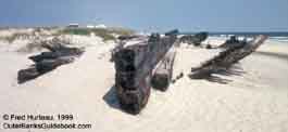 |
 |
 |
 |
 |
 |
 |
 |
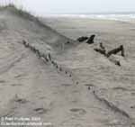
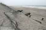
Update:
October, 2004 - More of L.A.Barnes Visible
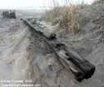
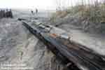
The
photos above were taken in April, 2004. The L.A. Barnes wreck
was visited again in October of 2004 to see what changes had
occurred during the extremely busy 2004 hurricane season. Compare
the two images below, and the two images at right, taken 6 months
apart from similar angles. It can be seen that a bit more of
the wreck is visible in the later October images. |

October,
2004 |

October,
2004 |

April, 2004 |

April, 2004 |
There
are many more shipwrecks to see.
Continue to Folklore and History - Page
Two > |
|


